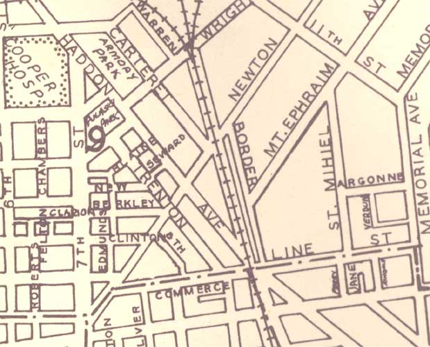
1946 Map of Camden — Argonne Street
1946 map of Camden. Argonne Street can be found on the right of the map, running east to west between St. Mihiel Street and Memorial Avenue, north of Line Street.
View transcription
[illegible]
COOPER
HOSP
WARREN
WRIGHT
11TH AV
ST MEMOR
HADDON
CARTER
ARMORY
PARK
NEWTON
PULASKI
PARK
9
ST
6TH
CHAMBERS
SEWARD
[illegible]
TRENTON
AVE
MT. EPHRAIM
BORDER
NEW
B[?]RKLEY
CLARION
FELTON
EDMUND
7TH
CLINTON
8TH
ROBERTS
ARGONNE
ST. MIHIEL
VERDUN
ST
LINE
COMMERCE
JANE
[illegible]
[illegible]
ON
LIVER
MEMORIAL AVE
Advertisement