Camden, New Jersey

Camden History

Historical archives documenting the people, streets, and stories of Camden, New Jersey.

Welcome to Camden History, unsurprisingly about Camden, New Jersey, a city steeped in history and brimming with stories that have left an indelible mark on the tapestry of America's past. Situated on the banks of the Delaware River, Camden has a rich and complex history that spans centuries. From its indigenous Lenape inhabitants to the bustling industrial hub of the 19th and 20th centuries, and from its pivotal role in the Underground Railroad to its contributions to the birth of the recording industry, Camden has played a significant part in shaping the nation's narrative.

Camden's origins can be traced back to the early 17th century when European settlers first arrived in the region. Over time, it evolved from a quaint village into a thriving industrial center, earning it the nickname "The City Invincible" in the late 19th century. The city's industries, including shipbuilding, manufacturing, and commerce, contributed to its growth and prosperity.

But Camden's history is not just one of industry and commerce; it's also a story of resilience, community, and cultural diversity. Throughout its past, the city has been home to waves of immigrants, each adding their unique traditions and flavors to the city's vibrant cultural mosaic.

Join us on a journey through time as we explore the people, places, and events that have shaped Camden's captivating history. From the waterfront to the neighborhoods, from famous figures to everyday citizens, we invite you to discover the hidden gems and untold tales that make Camden a city worth exploring and celebrating.

Remnants of Camden's history are all around you if you know where to look!

Beach Street 2004-06
Streets

Beach Street

Beach Street was a short North Camden street that ran from York to Erie Street, made impassable around 2000 when Delaware Avenue was extended. Only three houses were ever listed on the street: 930, 932, and 934.

·2 min read
Baxter Street and Mount Ephraim Avenue
Streets

Baxter Street

Baxter Street (formerly Newton Street and locally known as "Hog Alley") ran from South 7th Street to Mount Ephraim Avenue in South Camden, notorious for decades as a hub of illegal activity; largely demolished, the 700 block survives as an overgrown alley.

·2 min read
1906 Sanborn map showing the Barton Street area
Streets

Barton Street

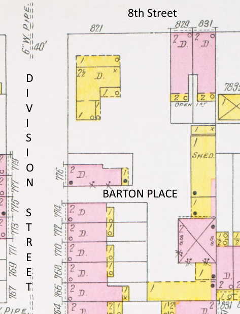
Barton Street, also known as Barton Place, runs for half a block south from 774 Division Street in Camden, first appearing in city directories in 1890; satellite photos from the early 2000s show it providing access to a church parking lot.

·1 min read
Streets

Bartlett Walk

Bartlett Walk is in the Crescent Gardens development at the southern end of Camden's Fairview section, built between 1924 and 1942, running southwest from Independence Road to the development's property line.

·1 min read
Bannard-Alley-2004-05-2
Streets

Bannard Alley

Bannard Alley (also known as Bannard Avenue) runs southeast from Kaighn Avenue toward Mechanic Street along the elevated railroad tracks. It likely originated as a service road for the rail line and has no residential or commercial addresses, serving primarily as a pedestrian and bicycle shortcut.

·1 min read
Streets

Bank Street

Bank Street runs from Baird Boulevard and Carman Street southwest, crossing Marlton Pike, to Admiral Wilson Boulevard. Once the center of a notorious open-air drug market in the 1980s–90s, the street was redeveloped as part of the Peter J. McGuire Gardens housing project in the early 2000s.

·1 min read
1906 Sanborn Map of the 600 block of Avon Street, South Camden
Streets

Avon Street

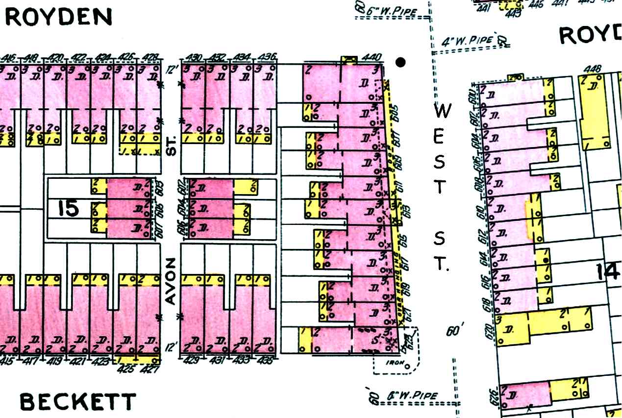
Avon Street is a one-block thoroughfare in South Camden running from Royden Street south to Line Street, between West Street and South 4th Street, intersected by Beckett Street. Six two-story brick homes lined the street by 1906.

·1 min read
Streets

Auburn Alley

Auburn Alley runs north and south from Washington Street, east of South 6th Street, behind the homes on Chambers Avenue. Today only a portion of the original alley is accessible, with residences encroaching on the Berkley Street side.

·1 min read
1946 map of Camden showing the Fairview section and Alabama Road
Streets

Atlanta Road

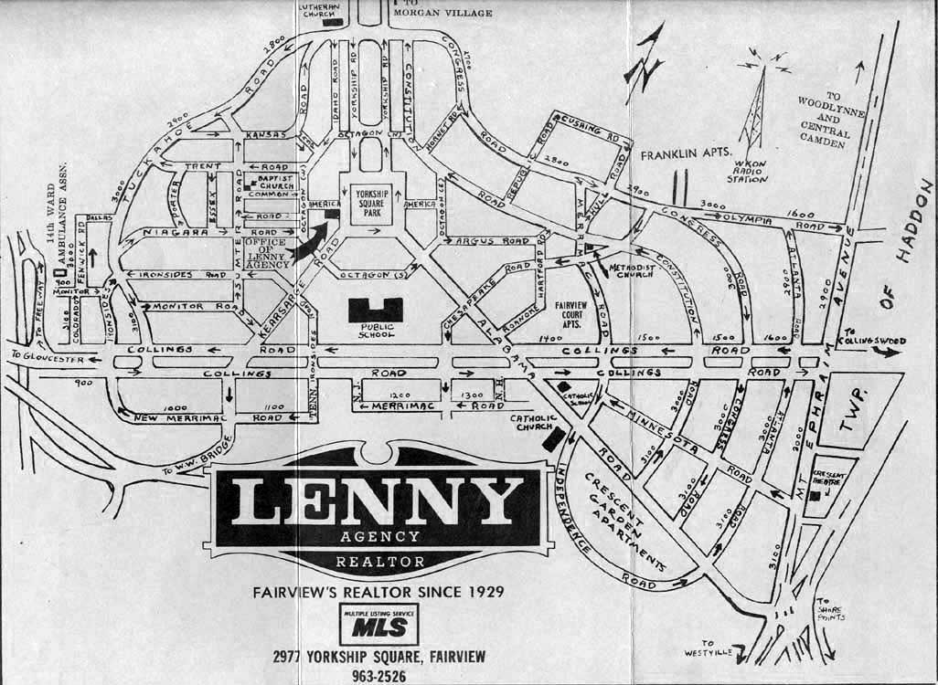
Atlanta Road runs north to south through the Fairview section of Camden, from Olympia Road to Alabama Road, paralleling Mount Ephraim Avenue. The northern segment (North Atlanta Road) ends at Collings Road; the southern segment (South Atlanta Road) continues to Alabama Road.

·2 min read
Arnold Street, 2005 map
Streets

Arnold Street

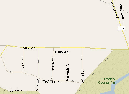
Arnold Street is a street in the Morgan Village neighborhood of Camden, built after 1947 and named after Admiral Henry "Hap" Arnold, who led U.S. Army Air Forces against Japan in World War II.

·1 min read
General Gas Mantle Company - Jefferson Street - 1926
Streets

Arlington Street

Arlington Street in South Camden ran one block and virtually disappeared after demolition in 2004. The street was home to working-class families, the General Gas Mantle factory (which caused thorium contamination), and became an EPA Superfund site in 1996.

·20 min read
1946 map of Camden showing the Fairview section and Alabama Road
Streets

Argus Road

Argus Road runs eastwards from East Octagon Road to North Constitution Road in the Fairview section of Camden.

·2 min read